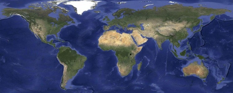
In an effort to provide a more accurate and comprehensive view of our planet’s landscape, Google recently announced plans to roll out new cloud-free satellite imagery across all relevant mapping products. The effort provides a stunning view of our planet that is virtually cloud-free.
In a blog post on the matter, Google said they took hundreds of terabytes of data from the USGS’s and NASA’s Landsat 7 satellite. It wasn’t uncommon to snap dozens of photos of a single spot in the world and analyze them to ensure they only used images with a clear view of every area. This was especially true in tropical regions that are always at least partly cloudy.
The end result is a massive 800,000-megapixel image of our planet that can be viewed in Earth and Maps when zoomed out to a global view. Matt Hancher, tech lead for Google Earth Engine, notes that the image is so big that you’d need a piece of paper the size of a city block to print it at a standard resolution of 300 dots per inch.
Google also added refreshed imagery in many regions of the world where high-resolution imagery was previously not available such as in parts of Russia, Indonesia and central Africa.
Those interested in checking out the new images are encouraged to open Google Maps and turn on satellite view or launch Google Earth and zoom out.
https://www.techspot.com/news/53056-google-infuses-mapping-products-with-cloud-free-imagery.html