Google infuses Earth and Maps apps with super sharp satellite imagery

Shawn Knight

Posts: 15,306   +193
Staff member

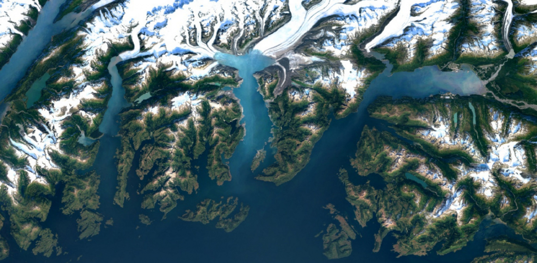
It’s been nearly three years to the day since Google rolled out its cloud-free mosaic of the world in Google Earth. Now, the teams behind Google’s popular world imagery platforms have announced another refresh featuring the latest imagery from NASA’s Landsat 8 satellite.

Google Earth Engine Program Manager Chris Herwig explains that Landsat 8 is superior to its predecessors in multiple ways. Images captured feature far greater detail, truer colors and come at an unprecedented frequency as Landsat 8 snaps twice as many photos as Landsat 7 each day.

To get a cloud and weather-free view of our planet, Google combs through an enormous amount of data – we’re talking nearly a petabyte of satellite imagery – to find the best shots to stitch together. To put that much data into perspective, it’s more than 700 trillion individual pixels – 7,000 times more pixels than the estimated number of stars in the Milky Way Galaxy and roughly 70 times more pixels than the estimated number of galaxies in the Universe.

Of course, it’s not as if Google has employees that manually go through all of these images but still, it’s a lot of work even when processed by computers.

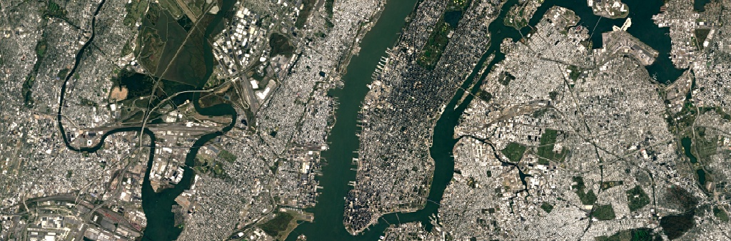
Herwig says the new imagery is now available across all of their mapping products (Google Earth and Google Maps) although as of writing, nothing has changed yet (at least, on my end). Even in major cities like New York City that are highlighted in the blog post, I’m still seeing the old imagery. Many people in the comments section are experiencing the same issues so it may take a bit of time before the new data reaches everyone.

Permalink to story.

 
Great stuff! Of course they will no doubt continue to blur highly sensitive sites and "real time" viewing will probably never happen, but I've used it for so many projects over the years, it is impressive and a God Send for aerial surveys, real estate verification, and just fun looking for that topless gal that is out sunbathing. Oh wait, we have a full sunshine day now ...... gotta go!!!
 
Great stuff! Of course they will no doubt continue to blur highly sensitive sites and "real time" viewing will probably never happen, but I've used it for so many projects over the years, it is impressive and a God Send for aerial surveys, real estate verification, and just fun looking for that topless gal that is out sunbathing. Oh wait, we have a full sunshine day now ...... gotta go!!!

I think it's really fun exploring places around the world with street view. I think it would be a really neat feature if people could upload virtual tours of locations.
 
I live in NYC, and when viewing Google Earth, I always turn the date back to June 11, 2011. Nice, bright and sunny, while all the days after that are horrible.
 
Great stuff! Of course they will no doubt continue to blur highly sensitive sites and "real time" viewing will probably never happen, but I've used it for so many projects over the years, it is impressive and a God Send for aerial surveys, real estate verification, and just fun looking for that topless gal that is out sunbathing. Oh wait, we have a full sunshine day now ...... gotta go!!!

If you want realtime viewing, check out urthecast.com. You can order satellite 4k video content from them, and can even view a live feed (for free) of the ISS from their cameras as it rotates around Earth :)
 
Back