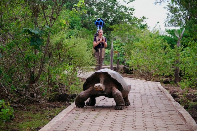
Google’s iconic Street View cameras recently visited Ecuador's Galapagos Islands and soon enough, you’ll be able to explore the some of the region’s most remote locations without leaving your house. The search giant deployed multiple camera-toting hikers to the Galapagos during a 10-day stint in an effort to better understand how invasive species, climate change and tourism affect the ecosystem.
Each hiker was equipped with what Google calls a “trekker” – a 42-pound backpack containing specialized computer and camera equipment. On top of the pack is a soccer ball-like orb that contains 15 cameras designed to capture panoramic views of its surroundings.
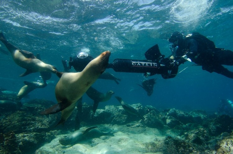
Project leader Raleigh Seamster said they hiked over trails and even down the crater of an active volcano. Because the Galapagos consists of multiple islands, much of the life is under the surface of the water. That’s alright though as Google teamed up with crews from The Catlin Seaview Survey to bring Street View underwater. The team was able to capture sea lions, sharks and other marine animals in their natural habitat, Seamster said.
Google’s iconic Street View is no stranger to some of the most beautiful and remote locations on the planet. Earlier this year the team traversed some of the most impressive mountain ranges in the world and shared imagery from the Fukushima disaster area in Japan. Last year Street View traveled to the Antarctic and in 2011 the company took Street View indoors with Business Photos.
Google is in the process of combing through all of the imagery and stitching it together. With any luck, it will be posted to Street View sometime later this year.
