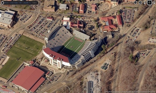
Microsoft has issued an update for Bing Maps that includes 215TB of high-resolution imagery covering the United States and key locations in Europe, Australia, New Zealand and Tokyo. These new snapshots, aptly named Bird's Eye, were captured at a 45 degree angle to provide increased detail of buildings and landmarks.
A post on the Bing Maps blog points out that photos in the new update cover over 230,000 square kilometers and consist of more than 1.1 million files. The service as a whole now spans a total of 1,388,593 square kilometers, good for 302TB of data.

Bird's Eye maps are comprised of three different kinds of data. The first is native Bird's Eye scenes containing photos captured at 45 degree angles. There's also Bird's Eye Oblique Mosaics which are a group of aerial photos that have been stitched together to form a seamless layer. The final type of data uses top-down photography that is projected onto a digital terrain or landscape at a 45 degree angle. This is used to showcase topological depth perception when traditional aerial photography isn't feasible.
To break down the new update, 84,451 square kilometers is brand new Bird's Eye Oblique Mosaic imagery while the remaining 145,553 square kilometers is refreshed Bird's Eye, replacing old and potentially outdated imagery.
I checked out some of the new imagery while working on this article and I must say that I am impressed with the results. Many of the local attractions I am familiar with through Google Maps actually look better using Bing Maps. If you haven't used Microsoft's alternative yet, it's certainly worth a try.