In brief: Getting around modern cities is hardly a straightforward process; especially for those who haven't lived in them their entire lives. Fortunately, services like Google Maps exist, which provide you with clear and concise directions to help you get from point A to point B. Today, Maps is about to get just a little bit better for anyone who needs "first and last mile" navigation assistance.
Starting today, Google will integrate services like Lyft and Uber directly into its navigation system (if you wish to use it) -- that's where the "first and last mile" navigation features come in. Put simply, Google Maps will automatically suggest alternate secondary transit options to get you to a primary method of transportation.
For example, if you enjoy biking, Maps could suggest a "tailored" cyclist route for you between your starting location and a train, bus, or subway station.
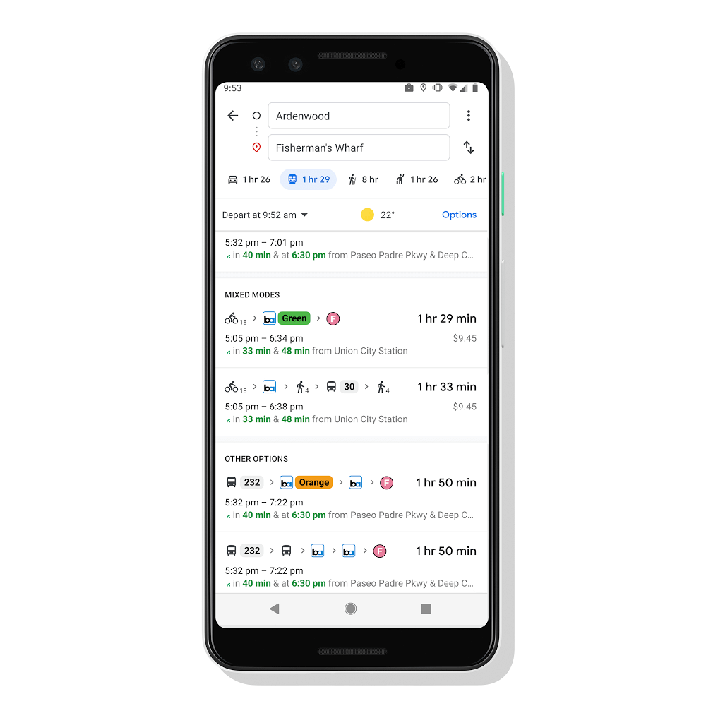
For the final leg of your journey, Google could suggest yet another cycling path, or a ride-hailing service like Uber or Lyft. You'll see these services pop up when you're plotting your initial route, along with brief glimpses of the specific options available to you (such as Uber Black or UberX) and estimated prices. All of this information, Google promises, is "automatically" factored in to your total travel time and your ETA.
In addition to whatever region happens to get this new Map feature today (likely the US and/or the UK), it will also be rolling out to 30 other countries in the "coming weeks," across both iOS and Android devices. Google is planning to expand that number in the future as well.
Image credit: Greenbot
https://www.techspot.com/news/81633-google-maps-now-suggest-ridesharing-cycling-options-first.html