In brief: Google this week announced the rollout of new visual improvements that’ll bring even more detail and granularity to its popular mapping application. It's not a huge change but when you already operate the top mapping app, every little improvement will only further extend your lead.
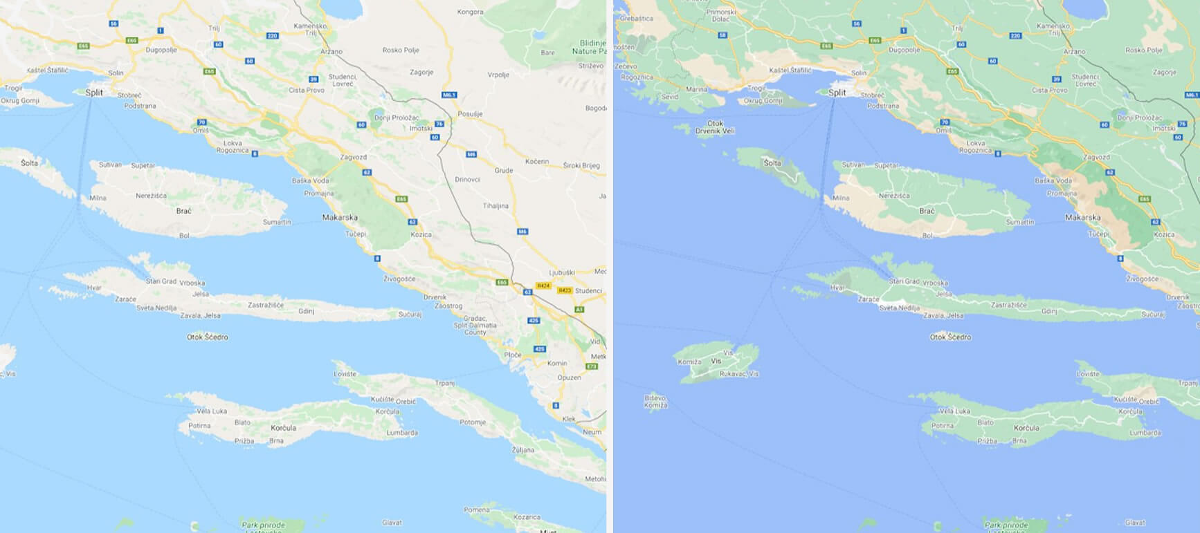
Google Maps already offers high-definition satellite imagery to more than 98 percent of the world’s population but there’s always room for improvement. Thanks to a new color-mapping algorithm, Google is now able to offer a more vibrant map of an area when viewing at a global scale.
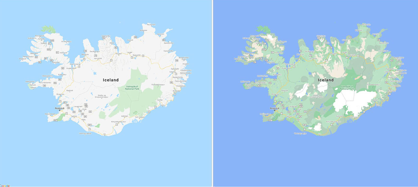
The technique utilizes computer vision to identify natural features in satellite imagery, then analyzes them and assigns a color from the HSV color model. This means users will be able to see snow caps on mountain top peaks, blue lakes, lush green vegetation and tan beaches at a glance. There are even varying shades so, for example, you can visualize greenery density in a particular region with ease.
Google is also working to update Maps with highly detailed street information that’ll illustrate the shape and width of a road to scale. The tech giant noted that being able to see exactly where sidewalks, crosswalks and pedestrian islands are located could be crucial to those with accessibility needs and will be even more helpful moving forward as people increasingly opt for solo transportation due to the pandemic.
These new detailed street maps will be rolled out in New York City, San Francisco and London in the coming months before expanding to more cities. Google’s more colorful maps, meanwhile, start rolling out this week to users around the globe.
Masthead credit: BigTunaOnline
https://www.techspot.com/news/86436-google-maps-getting-more-detailed-more-colorful.html
