Mississippi licensing board says plotting lines on a satellite photo requires a surveyor's...

Cal Jeffrey

Posts: 4,176   +1,424
Staff member
Why it matters: Should an app developer have to get a surveying license to create a program that places boundary lines on a satellite image using only information that is already available to the public? Mississippi apparently thinks so and is suing a tech startup to prove it.

Mississippi’s Board of Licensure for Professional Engineers and Surveyors is suing Vizaline, LLC, a startup providing a risk-management tool to banks, for practicing “unlicensed surveying.” The firm has filed a countersuit claiming “that the board violated its First Amendment right to convey information to willing customers.”

In 2014, retired banker Brent Melton and GEO-Spatial and remote sensing expert Scott Dow formed a company called Vizaline and released an app called “Viza-Plat” that allows banks to assess loan risk by plotting lines over satellite imagery. The program uses public information to create an outline of the property that banks can look at to see if there is any need for further action to “resolve any discrepancies in the legal description” of the property.

“Using public data to draw lines on satellite photos is not surveying, it’s free speech,” Institute for Justice (IJ) Senior Attorney Paul Avelar told TechSpot via email. “You don’t need the government’s permission to use existing information to create new information and sell it to willing customers.”

The board contends that since Viza-Plat is capable of creating survey maps from public information, Vizaline needs a survey license to operate. It further demands that the company and its founders “immediately disgorge themselves” of any revenue they earned in Mississippi and return collected fees to its customers. This would effectively bankrupt the firm.
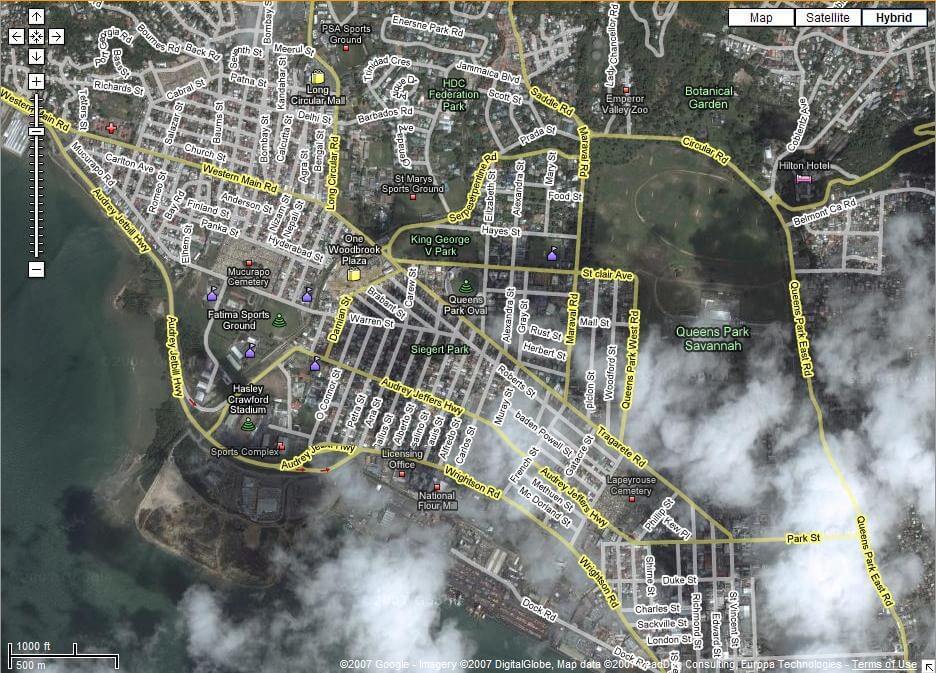
“The government shouldn’t force me to return all the money my clients paid when they are perfectly satisfied with our services,” said co-founder Brent Melton. “I just want to protect my right to provide my customers with valuable information to help their businesses.”

According to IJ, the suit against Melton and Vizaline is just one in a “nationwide trend” of bureaucratic obstructionism that hinders free speech. Steve Cooksey, a paleo-diet blogger, was ordered to cease providing dietary advice online by the North Carolina Board of Dietetics/Nutrition in 2011. In 2013, family psychologist John Rosemond was sued by the Kentucky Board of Examiners of Psychology for “unlicensed practice of psychology because of advice published in his nationally-syndicated newspaper column.”

Indeed, just last year we reported on how the Oregon Oregon State Board of Examiners for Engineering and Land Surveying fined retired engineer Mats Järlström $500 for merely describing himself as an engineer in an opinion submitted to the board. It contended that since Järlström was not licensed to practice engineering in Oregon, he had no right to refer to himself as an engineer in the submitted documentation. He defeated the bureau in federal court.

“This is just the latest example of a licensing board needlessly expanding its authority to hinder new competition,” said Johanna Talcott, an attorney with the Institute for Justice. “The government should step out of the way and allow an innovative business like Vizaline to continue serving its customers.”

We reached out to the Mississippi board for comment but have not heard back. We will update you if it chooses to respond.

Permalink to story.

 
Google is not providing surveying services because they're not selling opinions on the location of property corners. This is comparable to someone selling opinions about your illness symptoms and then claiming they're not acting as a doctor.. hell, it's freedom of speech after all.

Original plat maps are not georeferenced so it requires someone to have an opinion about where property corners are. The app maker however is selling that worthless opinion and accordingly a buyer or lender relies on that opinion, suddenly there's a large liability created. The goal is to prevent this and protect the public from unlicensed practice that creates inaccurate information that people are basing very large financial transactions without understanding the underlying information is worthless.
 
Last edited:
Then require them to carry a healthy size of Commercial General Liability insurance (CGL) for any damages that may arise.
 
Original plat maps are not georeferenced so it requires someone to have an opinion about where property corners are.
I don't believe that is a true statement unless I misunderstood you. When you speak of "plat maps" what are you referring to? The term plat maps have been loosely applied to various types of maps. All officially recorded tract maps and parcel maps I have ever seen all reference one or more previously recorded reference points. Perhaps it is different in states other than California where I live.
 
Plat Lines, as used by real estate and county engineers to determine land ownership, etc. have always required a surveyor's signed map and are taken as "gospel" in real estate transactions BUT, there is no guarantee of correctness. In may states these boundaries have been and continue to be contentious, often due to no for of checks and balances. Regardless of the technology, having the same service via satellite could pose the same problem and when they make an error it could be by far more than a few inches or feet!
 
The retired banker should understand the importance of having a Professional Surveyor and Mapper (PS&M) prepare a boundary survey. If you ask an attorney, then I think most of them would agree that there are associated financial risk involved in any real estate conveyance. The PS&M will analyze the evidence found in the field along with recorded documents of written legal descriptions of record title lines when performing a boundary survey. When a GEO-Spatial expert places boundary lines of any parcel of land on a satellite image, then the placed lines are approximate positions only, therefore with approximate line locations how can any expert determine the true risk, such as encroachments, overlaps or gaps in parcels of lands and evidence of easements that may be found by making a field visit to the property.

In my opinion the retired banker should protect his clients by hire the true professionals who know how to protect the property owners in real estate transactions.
 
Not sure if this makes any difference, but this is from the company's app description.

Vizaline’s product Viza-plat is a polygon(s) of a particular property of interest, constructed from a property description and placed on imagery for visualization and general reference purposes only.

It is not a Legal Survey, nor is it intended to be or replace a Legal Survey.​

It's not buried in the ToS either. It's right up front, so I don't think they are trying to pass off the maps as precisely surveyed boundaries. The co-founder Brent Melton said that banks can use the app to assess their current property descriptions. In other words, it is used to compare the description to the actual plat map to discern discrepancies. If any are found the bank can send a surveyor out to verify and update the description. At least that's what I'm understanding. I don't think they are trying to pass the app off as a substitute for surveying.
 
Not sure if this makes any difference, but this is from the company's app description. I don't think they are trying to pass the app off as a substitute for surveying.
This is a classic tactic by anyone trying to avoid liability while peddling a dangerous product. Be as up front as possible, you're not liable for unintended misuse.. but please pay us for the service.

A company can't simultaneously say the data is good enough to make decisions on but not good enough to be relied on. Their definition of "what is a survey" doesn't matter, only the State Board's does.. that sentence is nothing more than an attempt to avoid that reality.
 
Then require them to carry a healthy size of Commercial General Liability insurance (CGL) for any damages that may arise.
No insurance provider in the world would cover an unlawful and unlicensed act. I can't setup a doctor's office and just tell the insurer to sell me a bunch of commercial liability service. The first question will be what service are you providing, oh are you licensed to do that?
 
I haven't taken the time to read previous comments. I'm a project manager at a reputable Land Surveying firm in the Seattle metro, I've been in the business since 2007, working with satellite imagery since 2010.

I build all of our jobs in relation to the state plane coordinate system with satellites properly aligned. I use public GIS data (where this co. likely got their boundaries) for references and report in weekly to local municipalities where I find gold-standard GIS properties 5, 10, 200 feet off on occasion. Satellite imagery is stretched, scaled and skewed in so many ways that it is not a consistent image, beyond that properties are not perfectly layed out or defined.

From the company statements, they say that is your property, what you're looking at, but we don't guarantee it. People are vesting massive amounts of money based upon that false information (and it is entirely false). They don't have near enough knowledge to sell what they've been selling.

Our counties and cities all have websites with live GIS maps overlaying property boundaries, contours and satellite imagery. In most cases people aren't allowed to use it for actual work of any nature, but it slips through the cracks.

When we get a job that has approved design from this data I can tell right away. We inform whatever planning dep't and the client, and our fees triple at least because of the time it takes us to legitimize everything.

One client's example of this whole situation is in the City of Seattle. They wanted to add on to their building, a minimum sized lot. A city permitter/planner or whoever looked at their public GIS map, said the satellite shows the fence on the line so just set back from that. The client poured the foundation per those instructions and hired us to check. They had to saw cut roughly 50 feet of it because of the angle their lot actually took relative the fence. Who compensated them the tens of thousands that cost based off some non-expert looking at a pretty picture online?

I've located every building and fence line in a large plat and checked it against satellites before. One line may match, nothing else will. The way those images are meshed together make it impossible to make it perfectly aligned. You're taking 2d images of set dimensions at random and ever changing angles then aligning them along an orthometric surface. The image panels alone have roughly 10-20 feet of crunched overlap on each edge from what I've seen out here.

If your land gets destroyed and you file a claim, then they require a survey (as they all do for anything FEMA related), then we find contradictory to your insurance, you aren't covered anymore. You'll spend years in court fighting that. Still think it's okay those guys are making money like this? Do you think they have any clue as to what I've talked about? Would it make them more or less criminal if they did?

I should mention that a Professional Land Surveyor is personally liable for any errors or damages caused by their aprocal for 36 years after the discovery. These guys aren't.
 
Last edited:
Google is not providing surveying services because they're not selling opinions on the location of property corners. This is comparable to someone selling opinions about your illness symptoms and then claiming they're not acting as a doctor.. hell, it's freedom of speech after all.

Original plat maps are not georeferenced so it requires someone to have an opinion about where property corners are. The app maker however is selling that worthless opinion and accordingly a buyer or lender relies on that opinion, suddenly there's a large liability created. The goal is to prevent this and protect the public from unlicensed practice that creates inaccurate information that people are basing very large financial transactions without understanding the underlying information is worthless.
They are selling a legal product, not cocaine. Hope the company sues the state. No different than blaming S&W for an armed robber shooting his victim...
 
I find several things interesting about this entire situation is that what the company purports to offer is pretty much the same thing most tax assessors offer for free. Either the banks aren’t sure what they are getting or they are misrepresenting the product. The only other option is the company itself is misrepresenting the product. Outside of that there are several other problems here.
When a surveyor is asked to retrace a deed he or she has several responsibilities. The guiding principal is to follow in the footsteps of the original surveyor and to determine the intent of the seller (grantor) and to a lesser extent the buyer (grantee) when the parcel was originally created. If a deed doesn’t close (the math doesn’t work) that is an ambiguity on the face of the document (patent ambiguity). This seems to be what this service is being used for the most. In my 35+ years experience just because the math on a land description is correct doesn’t indicate there aren’t other issues. I often deal with descriptions that work mathematically but appear to encroach on surrounding deeds, this is a senior rights issue. When land boundaries are created over time, from a common grantor, lines first established take precedence over newer (junior lines). Surveyors often have to research this to straighten out these issues. This is a common boundary establishment principle. Most problems with land descriptions only show up when the information on the deed is used to try and locate the boundaries on the ground (latent ambiguity). This will require the surveyor to use evidence outside of the description (extrinsic evidence) to resolve these issues. This evidence can take the form of oral (parol) evidence, historical evidence, and other recorded and unrecorded documents. Surveyors spend much of their time researching this data.
Sometimes the boundary doctrines of acquiescence, agreement, practical location and estoppel are used to answer the factual question, where is the boundary on the ground. Once again surveyors are trained to look at these items and weigh their value as evidence. When all else fails, surveyors often resort to the standard rules of construction to determine the intent of the description. These rules are near universal across the country. First a surveyor will look for natural markers (monuments). These are calls in descriptions for rivers, trees and other objects. Then the surveyor will look to artificial monuments, like rods and posts driven in the ground then to record monuments. Record monuments are calls for things like neighboring properties (adjoiners). The very last thing on the list is bearings and distances (measurements). This list to determine intent is used by courts across the land. The least reliable evidence are the measurements, but this seems to be what the most weight is being given to in this situation.
On the topic of GPS it is not what most people think. It is a wonderful tool but it simply locates points on the ground in a much more efficient manner than in days past. It still generates the same data that once required hours to gather, but it’s pretty much the same data, point positions. In order for a metes and bounds description to be correctly placed on a properly georeferenced photo the description needs to be georeferenced. I would guess less than 10 to 15 percent of most descriptions contain this type of data (State Plane Coordinates). So a big question becomes how is this company placing this data on the photos if the descriptions doesn’t contain these coordinates? Are they just assuming a physical feature in the photo is a boundary line (line of possession)? If so, this is surveying without a license. I haven’t even talked about the rights that could rise out of long held possession (adverse possession). This is a title doctrine that only a court can deal with but a surveyor gathers evidence for.
Courts have said for years the following:
“It is not the office of a description in a deed of conveyance to identify the land intended to be conveyed, but to furnish the means of identification”

Collins V. Dressler (1892) 133 Ind. 290, 46 N.E. 526, Ault v. Clark (1916) 112 N.E. 843


“The descriptive clause in a deed provides the means for identification of the land, but is not intended to identify the land.”
Clark v. CSX Transportation, Inc. (2000) 737 N.E. 2nd 752


Title companies, for years now, have used deed plotting software to check for math problems in descriptions, which is a good thing. This doesn’t answer the many other problems that can arise with land issues. I would also assume that the product being offered doesn’t remove the standard survey exception from a title policy. Use it for what you will but realize measurements are only a small part of the equation, so to speak.

A good decision is based on knowledge and not on numbers. - Plato
 
Back