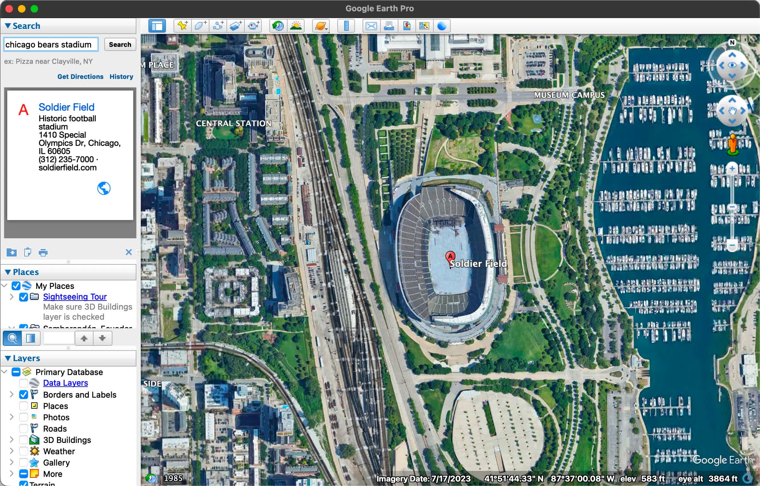
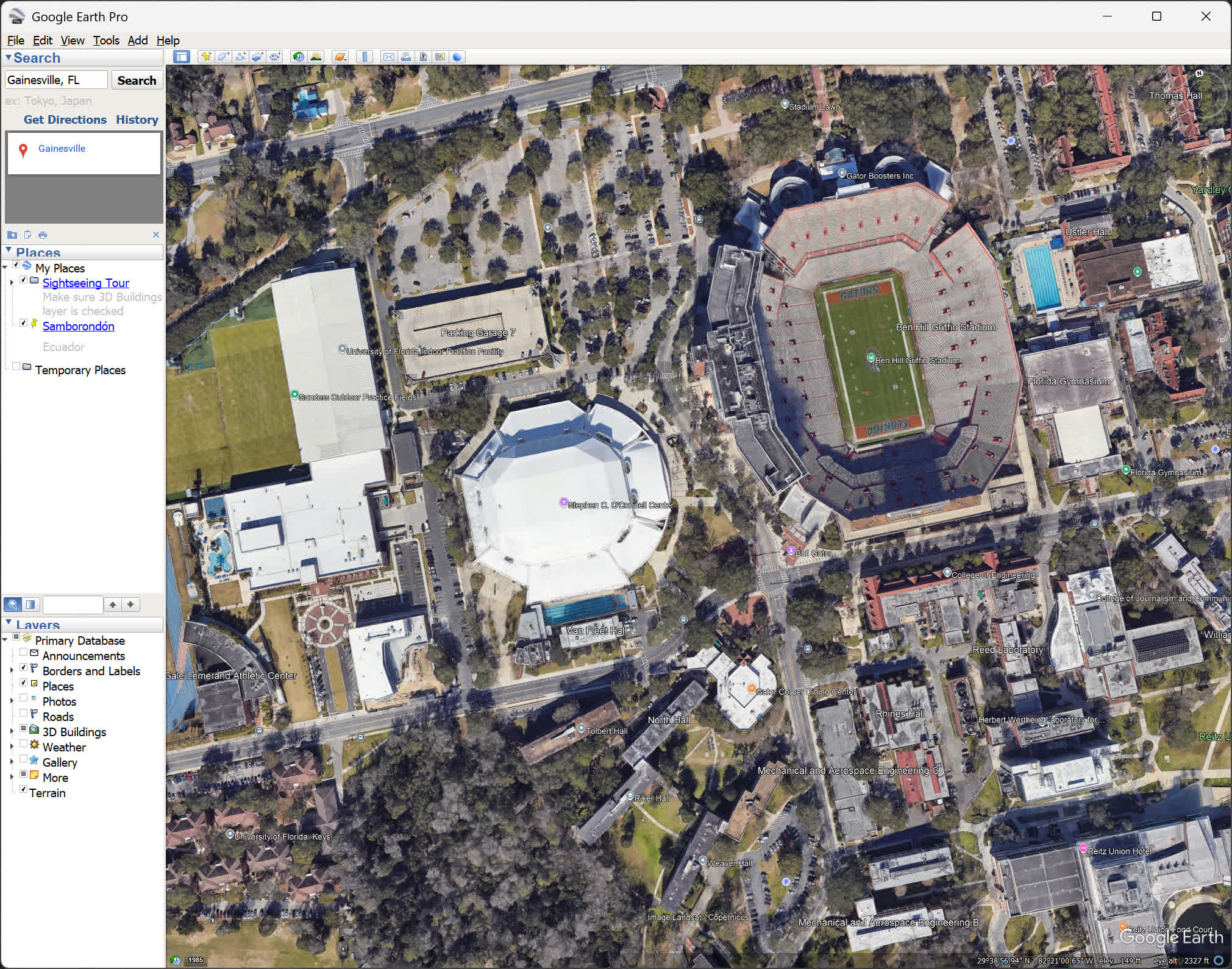
Google Earth Pro desktop app is now free and available for download on Windows, macOS, Android, and Linux. Explore worldwide satellite imagery and 3D buildings and terrain for hundreds of cities.
Zoom in to your house or anywhere else, then dive in for a 360° perspective with Street View. It provides an immersive way to explore the planet, whether you're planning trips, studying geography, or visualizing real-world data.
With Google Earth Pro, you can:
- Explore detailed satellite imagery and 3D buildings across hundreds of cities.
- Zoom in anywhere on Earth, from your neighborhood to remote locations.
- Use Street View for a 360° interactive experience.
- Import and analyze GIS data, create maps, and record high-definition video tours.
- Access historical imagery to see how places have changed over time.
For users with advanced feature needs, Google Earth Pro lets you Import and export GIS data, and go back in time with historical imagery. Some of the most compelling features of Google Earth include:
- Advanced Measurements: Measure parking lots and land developments with polygon area measure, or determine affected radius with circle measure.
- High-resolution printing: Print Images up to 4800x4800 px resolution.
- Exclusive Pro data layers: Demographics, parcels, and traffic count.
- Spreadsheet Import: Ingest up to 2500 addresses at a time, assigning placemarks and style templates in bulk.
- GIS import: Visualize ESRI shapefiles (.shp) and MapInfo (.tab) files.
- Movie-Maker: Export Windows Media and Quicktime HD movies, up to 1920x1080 resolution.
Do I have to pay for Google Earth Pro?
Google Earth Pro is free to use, no matter if you download it as an app or use it as a web service. Google used to charge an annual fee for Google Earth Pro but that is no longer the case.
Can I see my house from Google Earth?
Yes, you can see your house on Google Earth. By entering your address into the search bar, you can zoom in to view high-resolution satellite images of your area. In many locations, you can also use Street View to get a 360-degree ground-level perspective.
Can I import GIS data like Shapefiles into Google Earth Pro?
Absolutely. Google Earth Pro supports the import of ESRI Shapefiles (among other formats), and enables you to overlay polygons, points, and attributes onto the globe. It's a simple way to share spatial data – users often package data into KMZ files that others can open with a double-click.
Is it possible to batch-edit or recolor placemarks via Excel and re-import them?
While you cannot edit KMZ or KML files directly through Excel, there's a helpful workaround: import the file into "My Maps" (the web-based map editor), where you can easily change pin icons, colors, and other attributes, then export the updated map and bring it back into Google Earth Pro.
Which is better: Google Earth or Google Maps?
If you need street navigation and turn by turn directions, Google Maps is the better choice. If you're looking to explore places from a bird's eye view, then you should download Google Earth. Both services share map information, but which is better will depend on the use you plan to give them.
In short, Google Earth is for discovering the world, while Google Maps is for getting around in it.
Is Google Earth live?
Google Earth is not live. The images you see are satellite and aerial photographs that were captured at different times and then stitched together. Depending on the location, the imagery could be just a few months old or several years outdated. For most urban areas, updates tend to be more frequent, sometimes annually or even more often, while remote regions may go much longer without changes.
Google Earth Pro also lets you access historical imagery, so you can scroll back and see how places have evolved over time, but there is no real-time video feed.
Features
- Regionate large datasets
- Batch geocode addresses
- Import GIS data
- Access demographic, parcel & traffic data layers
- Create premium movies
- Measure area of a polygon or circle
- Map multiple points at once
- Viewshed tool
- Map making tool
What's New
- Google Earth 10 KML compatibility improvements
- Support for gx:CascadingStyle KML extension; KML features imported from Google Earth 10 retain styles like icons, line widths, and colors.
- Support for other extensions found in KML exported from Google Earth 10.
- Fix for app launch issue on some recent Linux releases.
- Measurement tool and property editor measurement tab use the same unit selection.
- GeoTIFF imports or super overlays can be saved as KMZs that can be opened in Google Earth 10.
- Other minor fixes and improvements.
Other changes
- Fix for app launch issue on some recent Linux releases.
- Measurement tool and property editor measurement tab use the same unit selection.
- GeoTIFF imports or super overlays can be saved as KMZs that can be opened in Google Earth 10.
- Other minor fixes and improvements.
Desktop 7.3.6
Here are highlights of the fixes, changes, and improvements we've made for this release of Google Earth Pro:
- Movie Maker tool:
- Hardware-accelerated video encoding for faster processing and better image quality.
- HEVC (H.265) codec support.
- Full navigation controls, including Historical Imagery and Street View, available in live recording mode.
- Better responsiveness during live recording.
- Can defer video encoding until after live recording is finished.
- In live recording mode, less obtrusive recording status dialog.
- Live recordings accurately show the timing of user actions during the recording session.
- Save video frames in QOI image format.
- Break apart a Multi Geometry place mark into individual place marks.
- Combine multiple selected place marks into a single Multi Geometry place mark.
- Import GeoJSON files.
- Improved printing tool quality.
- Save Image tool:
- Increased maximum image size.
- PNG format support.
- Adjusted Google Earth logo size in main view, saved images, and printouts.
- Windows: Automatically support high-DPI displays.
- macOS: Fix illegible dialog tabs on macOS 11+.
- macOS: Cosmetic refinements to My Places and Layers panels.
- Regionate tool supports KML Schema extended data.
- Consistently save KML files with no changes from session to session.
- Correctly import CSV files with values that contain quotation marks.
- Edit KML LinearRing place mark line style.
- Other minor fixes and improvements.
Android
- An improved search experience now includes locations, suggested points of interest, data layers, and guided tours in Voyager.
Desktop 7.3.5
- Fixes for 3D controller devices on Mac and Windows.
- Resolves navigation bugs in Street View mode.
- Fixes distorted rendering of Street View imagery.
- Improved support of new map layers.
- Faster import of GeoTIFF files.
- Accurate stars and night sky background positions.
- Improved compatibility with recent Linux versions.
- Security updates and fixes.
- Other fixes and enhancements.