While iOS 6 users complain about the half-baked mapping experience they’re getting on their recently updated Apple devices, Google continues to take its Street View feature off the beaten path, this time allowing users to dive through the world’s oceans with the first underwater panoramas in Google Maps.
The search giant partnered with the Catlin Seaview Survey, a project focused on recording and revealing the world’s oceans and reefs, to provide “Sea View” experiences in six of the ocean’s most incredible living coral reefs: Heron Island, Great Barrier Reef; Lady Elliot Island, Great Barrier Reef, Wilson Island, Great Barrier Reef; Apo Island, Philippines; Oahu, Hawaii: Hanauma Bay; Maui, Hawaii, Molokini Crater.
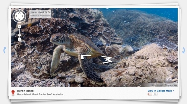
The imagery was captured with a specially designed underwater camera, the Catlin Seaview SVII, which takes high-resolution, 360-degree pictures every 3 seconds while traveling at a speed of approximately 2.5 miles per hour. The idea is to give scientists around the world a tool to monitor change in marine environments now and in the future, while giving the rest of the world a cool way to explore the oceans from their own desks.
“Whether you’re a marine biologist, an avid scuba diver or a landlocked landlubber, we encourage you to dive in and explore the ocean with Google Maps,” the company wrote in a blog post announcing the new feature.
In addition to the new undersea imagery, Google also announced new Street View data for Chile and Croatia.
https://www.techspot.com/news/50317-google-takes-maps-underwater-explores-worlds-coral-reefs.html
")
