GPS is getting jammed in the Strait of Hormuz, and ships are appearing in circles

Skye Jacobs

Posts: 2,030   +59
Staff
What we know so far: When senior maritime intelligence analyst Michelle Wiese Bockmann opened a live vessel-tracking map of the waters off Iran, the United Arab Emirates, and Qatar, she saw a sight that defied logic. Hundreds of commercial ships appeared bunched into near-perfect circles, some even hovering on land – an impossible scene in one of the world's busiest maritime corridors. The clusters were not a data glitch but the visible footprint of an invisible war: large-scale GPS interference sweeping across the Strait of Hormuz.

The interference has scrambled the Automatic Identification Systems (AIS) that ships rely on to share their positions. That means tankers carrying hundreds of thousands of tons of oil may not know exactly where nearby vessels are – a potentially catastrophic problem in narrow waterways, where even a small navigational error can trigger an environmental or security crisis.

"We can't over-estimate the huge danger this places to maritime navigation and safety," Bockmann, who tracks real-time anomalies at maritime AI company Windward, told the BBC.

GPS jamming works by overwhelming a satellite receiver with counterfeit or high-power signals, preventing it from locking onto genuine transmissions from orbiting satellites. Because legitimate Global Navigation Satellite System (GNSS) signals are faint – roughly equivalent to the power of a 20-watt light bulb spread across the entire Earth – even modest jamming equipment can blind location systems within several miles.
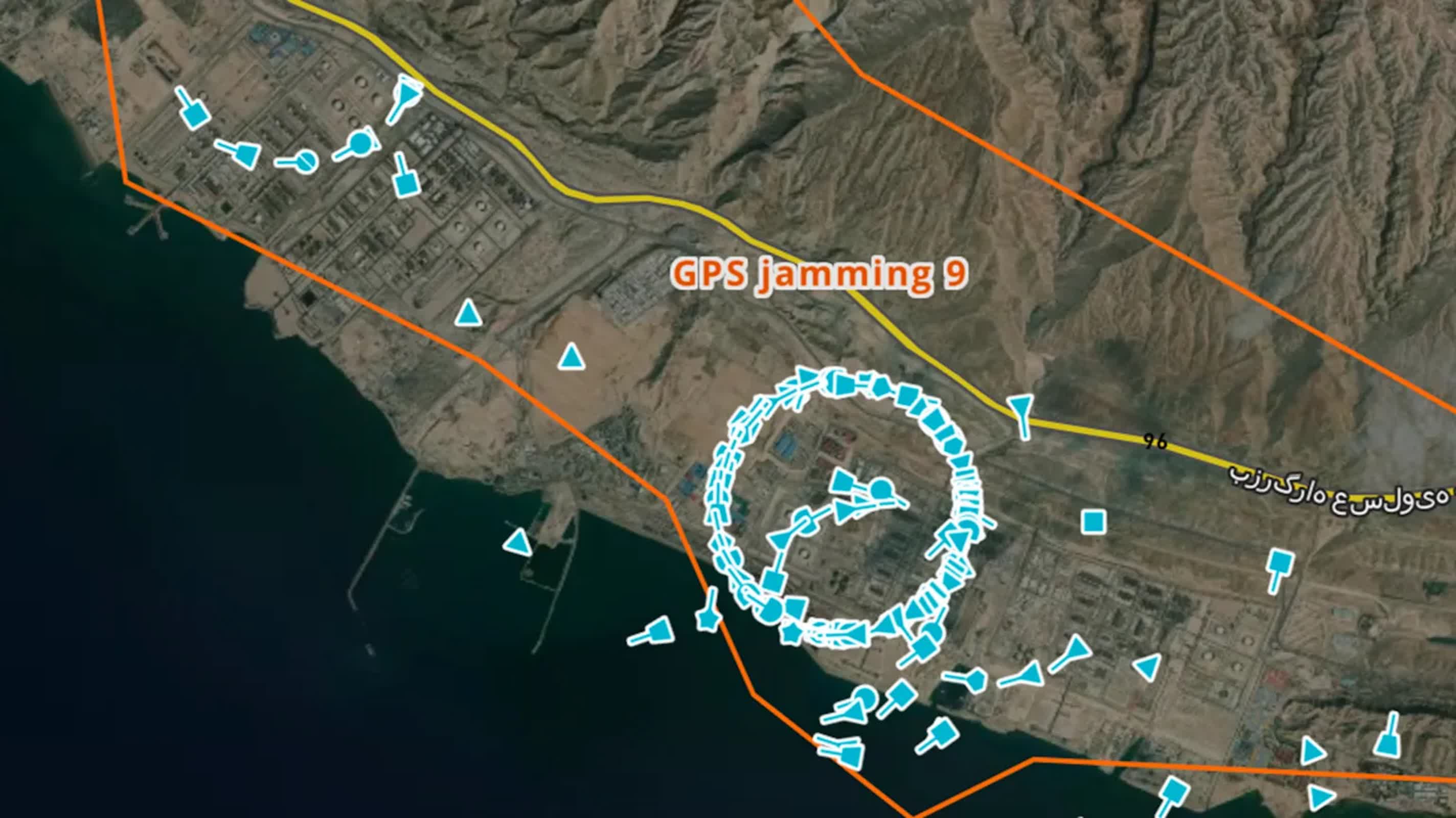
Electromagnetic interference of this kind is not new. It has become a daily feature of electronic warfare in Ukraine and was recently blamed for disruptions to aircraft navigation over Europe, including a plane carrying the President of the European Commission. But analysts say the current interference blanketing the Strait is unprecedented in both scale and precision. "This is next-level," Bockmann observes.

Neither Iran nor any foreign military has acknowledged responsibility, yet experts strongly suspect multiple actors. Iran has previously used jamming tools – likely sourced from Russia or China, or built domestically – to disrupt foreign vessels and drones. Western analysts also note that US forces in the region likely employ counter-jamming systems to shield bases and ships from GNSS-guided weapons, potentially creating a dense electromagnetic battlefield in which both offensive and defensive signals coexist.

Detecting jamming activity can be as complex as navigating through it. When the war in Ukraine intensified, US technologist Sean Gorman and his team at Zephr.xyz used smartphones attached to drones to measure GNSS interference. The devices collected satellite-signal strength data, making it possible to triangulate jammer locations on a map. Gorman says the data revealed where jammers were operating and the strength of their signals.
More recently, with Iranian airspace closed to civilian aircraft, Gorman used radar satellites to spot the same telltale distortions in radio frequencies. The interference appears as faint patterns in the radar returns – a kind of digital fingerprint left by the jamming devices themselves. These traces have revealed widespread disruptions around Iran and the wider Gulf.

Maritime safety agencies, including Pakistan's National Hydrographic Office, have already issued warnings about the interference. A collision in these waters could have global economic consequences, given that roughly one-fifth of the world's crude oil passes through the Strait of Hormuz.

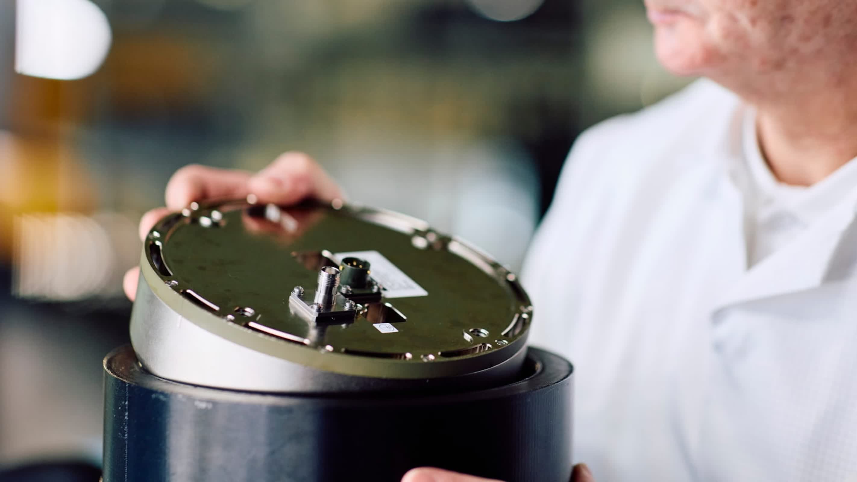
Defense contractors and navigation firms are now racing to build tools that can operate in jamming-heavy zones. Raytheon UK's "Landshield," a puck-sized anti-jam antenna system, uses multiple channels to maintain stable positioning even under attack. "We're seeing quite an increase in demand and capacity for our anti-jamming products at the moment," said Alex Rose-Parfitt, the company's engineering director.

Other firms are developing GPS-independent navigation systems. Australia's Advanced Navigation uses gyroscopes and accelerometers – similar to those found in smartphones – to compute a vehicle's position relative to its last known coordinates.

The system can also cross-check optical imagery with satellite maps or even calculate location using star patterns, a modern nod to ancient celestial navigation. "Doing something like star-mapping is very inexpensive," says co-founder Chris Shaw. "It's just not very accurate. That's why you need multiple forms of location and position analysis."

The vulnerability of GPS lies in its openness. Civilian GPS operates on unencrypted signals that are easily mimicked or overpowered, while military systems use M-Code, an encrypted, authenticated form far more resistant to intrusion. Experts believe that the civilian navigation landscape will soon undergo the same kind of evolution Wi-Fi networks experienced, shifting from open and unsecured to tightly protected.

Ramsey Faragher of the Royal Institute of Navigation argues that the Gulf disruptions mark a larger turning point for global navigation. "Soon, we will look back on this era where we are using open GNSS signals and think, 'God, we were mad, that was really not a smart move,'" he says.

Image credit: BBC

Permalink to story:

 
The author appears to conflate GPS and AIS, despite their being entirely separate systems (sorry, Skye). For a large ship, GPS jamming and spoofing is relatively easy to counter using directional antenna. AIS is rather more difficult ... but AIS is intended as a backup system; ships this size are required to operate safely even in the total absence of AIS.
 
Well it should be fairly easy to detect where this massive amount of EM interference is coming from. If you have to broadcast this much EM to jam signals your like a lighthouse in the middle of the ocean
 
Well it should be fairly easy to detect where this massive amount of EM interference is coming from. If you have to broadcast this much EM to jam signals your like a lighthouse in the middle of the ocean
Maybe try reading the article. The interference is massive not because it's coming from a single "lighthouse" as you put it, but rather because it's coming from multiple sources as well as being mixed with signals from counter-jamming equipment. I doubt it will be easy to find who is responsible.
 
Maybe try reading the article. The interference is massive not because it's coming from a single "lighthouse" as you put it, but rather because it's coming from multiple sources as well as being mixed with signals from counter-jamming equipment. I doubt it will be easy to find who is responsible.
While it might take some plans recording the db volume of the radio sigals, it'll be pretty easy and some simple math. Expensive? Absolutely. Hard? no. And considering the US has already decided that throwing money at problems I don't think this will be hard to figure out. Also, the F-35 can detect radio signals from 500miles away, and those are just the numbers we release on it. We have over 50 of them there right now and I think Israel has another 30. So, yeah, Figuring out who is jamming what from where should take the 80 F-35's a couple hours
 
The author appears to conflate GPS and AIS, despite their being entirely separate systems (sorry, Skye). For a large ship, GPS jamming and spoofing is relatively easy to counter using directional antenna. AIS is rather more difficult ... but AIS is intended as a backup system; ships this size are required to operate safely even in the total absence of AIS.

Fair point that AIS and GPS aren’t the same thing, but AIS position data usually comes from the ship’s GNSS feed. So if GNSS gets jammed, AIS tracks can look broken too. That’s probably what the article is getting at.

And sure, ships aren’t supposed to rely on AIS alone for safe navigation, but in a crowded area like Hormuz, messing with shared position data is still a serious safety issue. Feels more like a technical nuance than some big gotcha.
 
While it might take some plans recording the db volume of the radio sigals, it'll be pretty easy and some simple math.
You're absolutely correct that locating these signals aren't difficult; I've read of some private firms already doing this. I believe the primary issue though is in responding ... the transmitters can be quite small and mobile, and we likely don't want to use a HARM missile on someone a crowded cafe in Hormuz or Bandar Abbas.

So much winning so much gas prices
US gas prices:
Jan 2021: $2.420 /gal
Jun 2022: $5.032 /gal
Today: $3.67

Biden doubled the price of gas in under two years, and kept it high his entire term. Gas prices have spiked all of two weeks. And given how quickly oil is dropping, in another 2-3 weeks, they'll again be well below what we inherited from Biden.

 
FFS can we not navigate like they did hundreds of years ago. DO we not have compasses, sextants, charts, the sun, the stars, eyes!
 
FFS can we not navigate like they did hundreds of years ago. DO we not have compasses, sextants, charts, the sun, the stars, eyes!
None of the above save the compass work on a dark and cloudy night, and even a compass isn't fully accurate aboard a large metal ship. And hundreds of years ago, shipwrecks due to navigational error were commonplace, even in daylight, not to mention that a Spanish galleon or three-decker turns much faster than does a 300,000 ton supertanker.
 
FFS can we not navigate like they did hundreds of years ago. DO we not have compasses, sextants, charts, the sun, the stars, eyes!

If only navigating through clear waters was the only issue.....

The bigger issue is what are all the other ships doing, where are they heading. Unfortunately it takes a long time for a big ship to stop or turn, if two of them are heading towards each other (could be in the same direction) without knowing each others speed or direction they could crash.

I believe its more about where are the other ships, and where are they heading, then just the coast line, reefs and bathymetry.
 
No. England will no longer control and manipulate the region. You will see.
This will be the biggest win yet for global stabilization.
Yes.........we totally controlled Iran....................LOL.............keep taking your medicine.
 
Yes.........we totally controlled Iran....................LOL.............keep taking your medicine.
I didn't write "...we totally controlled Iran", you did. It's not for me to convince you. England though no longer a world empire still has lots of money. That money is made by a volatile Middle East, the rise and fall of oil prices. England sows dissent in the region to make money off of oil. They couldn't do that if they used North Sea oil which they don't. England was once ruled by Lord's and Lady's then the socialists kicked out Churchill and the socialists took over. Now England is controlled by the socialist oligarchy and the common, working man is again eating greasy fish and chips paper.
 
Back